Bearspaw Acreage Excavation North of the Bow River
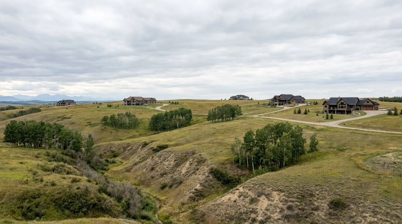
Bearspaw is a country residential community of Rocky View County on the north side of the Bow River, with Highway 1A along its southern edge and a boundary that adjoins the City of Calgary. Its two-acre parcels roll across slopes, coulees and wetlands that drain three different ways, so where the water goes decides where a house, a septic field and a driveway can sit. We excavate for custom homes, shops and private sewage systems here, and we plan every dig around the slope first.
At a Glance
- Municipality
- Rocky View County
- From our downtown office
- About 30 minutes northwest, north of Highway 1A
- Typical servicing
- A mix of piped servicing, water co-ops, wells and septic fields
- Postal prefixes
- T3L, T3R
Lots, Homes and Sites in Bearspaw
The Bearspaw Area Structure Plan sets residential parcels at a minimum of 0.8 ha (1.98 acres), commonly called two-acre lots, and it is candid about why: the servicing standards for private sewage disposal systems made parcels of about two acres the common baseline. Agricultural parcels in the plan area start at 14.2 ha (35 acres). The result is a community of single homes on land big enough to hold a septic field and a detached shop, and the excavation list on a typical build reflects it: a full basement, a shop pad, a septic tank and treatment field, and trenches for water, sewer and power running between them.
Servicing in Bearspaw is a mix. The County's Municipal Development Plan lists municipal piped servicing, private water co-operatives, and private wells and septic systems, and the ASP notes the community historically relied on wells, co-ops and septic fields. The same ASP looks ahead to a shift in focus from private sewage systems toward piped community and, ultimately, regional systems. The plan sets a direction, not a construction date, so a home built today is built on whatever servicing the parcel has now, and we dig to what the approved permit shows.
Slopes change how a basement is dug. On a lot that falls away, the house often steps down to expose one basement wall on the low side, which moves a lot of material from the high side to the low side and needs cut-and-fill planning, so fill under a driveway or patio goes down in compacted lifts rather than loose piles. Excavations deeper than 1.5 m need cutting back or a protective structure before anyone works inside, and on a slope the uphill wall reaches that depth quickly.
Neighbourhood Notes
Along Highway 1A
Highway 1A forms Bearspaw's southern boundary in the ASP and, with Stoney Trail, is its main access in the County plan. Parcels on this side fall toward the Bow River catchment, so runoff control points south.
12 Mile Coulee Road
Named in the ASP as a gateway into the community. Before hauling fill or gravel along County roads from here, check whether the County needs a Road Use Agreement or permit for the loads.
Big Hill Springs Creek catchment
The northwest of the plan area drains to Big Hill Springs Creek, which also marks part of the western boundary along with the Town of Cochrane. Stripping and grading here need sediment control that holds before water reaches the creek.
Nose Creek catchment
The northeast of Bearspaw drains toward Nose Creek. Dugouts and yard regrading should keep runoff on its existing path; Alberta's dugout exemption from Water Act approval does not apply where a dugout would change the flow onto an adjacent parcel.
Coulee and slope lots
The ASP lists coulees and slopes among the landscape features it aims to protect. A basement or shop cut into a coulee side is where we want the geotechnical engineer involved early and cut-back angles set by soil type.
The Calgary boundary
The ASP says Bearspaw's boundary adjoins the City of Calgary. A parcel near that edge still answers to Rocky View County for permits and private sewage, even when the nearest houses across the line are in the city.
Lochend Road (Highway 766)
Mapped close to the Bearspaw area. Acreages reached from roads off Lochend Road need their approach and culvert checked with the County before the driveway is built.
Permits and Locates in Bearspaw
Authority having jurisdiction: Rocky View County
Bearspaw building permits and private sewage permits come from Rocky View County; our Rocky View County page sets out the County's foundation permit, sewage permit and inspection sequence in full. The Bearspaw-specific part is what lies under a rural parcel. Request locates through Utility Safety Partners at least 3 full working days ahead. Alberta's rules also require a check for any pipeline within 30 m of the work site, and a ground disturbance that comes within 5 m of a pipeline must expose it using hand excavation. Customer-owned lines, such as a well line, a septic system or the power feed to a shop, are not marked by the utility and need a private locate before our machine works near them.
The Excavation Work Bearspaw Calls For Most
Deep Basement Excavation
Full and walkout basement digs for new custom homes on open lots and acreages.
Septic System & Field Excavation
Test pits, tank holes and treatment field trenches for acreage septic systems.
Slope Stabilization & Erosion Control
Runoff diversion, benching, riprap, silt fence and revegetation on slopes and banks.
Retaining Wall Base Excavation
Wall base trenches, compacted levelling pads and drainage. We dig; your builder builds.
Driveway & Access Road Rough-In
Acreage driveways and access roads built on geotextile and crushed gravel.
Shallow Utility Trenching
Narrow trenches for gas, electrical conduit, fibre and suite power feeds.
Close to Bearspaw
Bow River infills in Hillhurst and Sunnyside, Mount Pleasant, and the northwest suburbs.
Two-acre country residential lots between the Bow and Elbow rivers, west of Calgary.
A Bow River town west of Calgary, with kettle terrain and slopes mapped in Rivercrest.
Growth hamlets, country residential communities and farmland beside Calgary.
Excavation in Bearspaw: Questions
Is Bearspaw moving to piped water and sewer?
How is digging a basement on a Bearspaw slope different from a flat lot?
Why are Bearspaw lots about two acres?
Digging in Bearspaw?
Call or send the details. Aspen Excavating works from downtown Calgary, and we will look at the site and the access before we price it.