Mass Earthworks & Site Grading in Calgary
We move earth to the elevations on your grading plan: strip and stockpile topsoil, balance cut against fill, and shape the lot with laser or GNSS machine control so water runs away from buildings. Calgary lots, acreages and development sites.
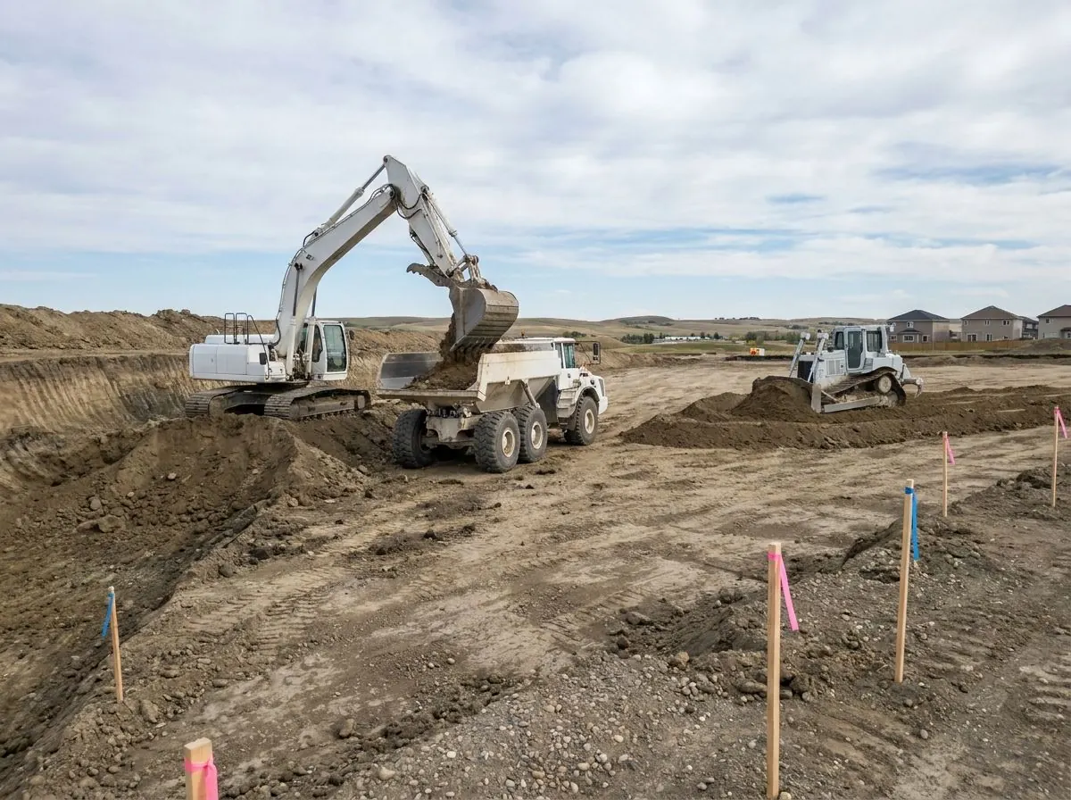
The Problem It Solves
Most grading problems are invisible on the day the machines leave. A lot that looks flat and tidy can still hold a low spot against the foundation, a swale that runs uphill by a few centimetres, or a yard that sheds its spring melt straight onto the neighbour’s property. Water finds every one of those mistakes. In Calgary, where the ground freezes and thaws through a long winter and the snow comes off in a rush, a grade that points the wrong way turns into wet basements, heaving walkways, soggy lawns and a failed grade inspection that has to be dug up and redone.
On bigger sites the risk is money in trucks. Earthworks are typically priced by volume, and every cubic metre that leaves the site is handled twice: once to dig it and again to haul it. When nobody checks whether the cuts on a site can feed the fills, a project exports good clay in one week and imports fill to the same property the next. Topsoil pushed into the subgrade is lost to the landscaping budget and leaves a soft, organic layer under a driveway or a slab. Every one of those errors starts as a grading decision made by eye rather than to a design elevation.
Then there is the paperwork. Calgary’s Lot Grading Bylaw 32M2004 exists to make sure that, at construction completion, new residential and commercial buildings have a properly graded lot with surface drainage directed away from them. The as-constructed grade certificate has to be signed by a professional land surveyor, engineer or architect, and that professional is confirming a grade that drains away from the building. A lot that was graded roughly and never checked against the design elevations can leave the certifier with nothing to sign, and the fix is rarely a single afternoon with a rake.
How It Works
We grade to numbers, not to what looks right. Before a bucket moves, we work from the grading plan and the design elevations, set up machine control, and confirm benchmarks against the survey. On a flat pad or a single-direction slope, a rotating laser sets a reference plane and a receiver on the blade or bucket tells the operator exactly how far above or below design grade the cutting edge sits. On a complex surface such as a walkout lot, a swale network or a multi-lot site, GNSS machine control lets the machine follow a 3D design model across the whole site.
We balance the site before we price the trucks. Stripping comes first: topsoil is peeled off and stockpiled separately so it stays clean for final landscaping and never ends up buried as a soft layer under fill. Then cut areas are opened and the suitable material is moved directly to the fill areas, placed in controlled lifts and compacted, rather than trucked away and replaced. Only true surplus or unsuitable material leaves the site, and only genuine shortfalls are imported. That cut-and-fill balance is where most of the savings on an earthworks job are won or lost.
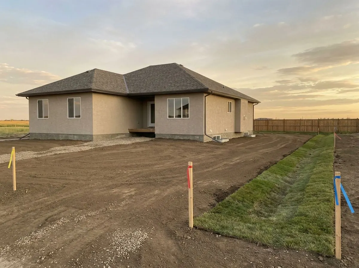
Rough grade and fine grade are separate stages with their own checks. Rough grade gets the bulk shape within working tolerance and lets the other trades build. Fine grade sets the final surface that water will actually follow, including the minimum 4% fall within 1.2 m of the foundation that Calgary’s Guide to Lot Drainage calls for, 2% across grassed areas and the shallow swale gradients that carry water to the street or a drainage facility. We check elevations as we go, so the surveyor certifying the as-built grade is confirming work that was built to the plan.
How the Job Runs, Step by Step
Plan review, benchmarks and locates
We read the grading plan, design elevations and any geotechnical notes, and confirm the site benchmark and control points with the surveyor. Utility locates are requested and private lines such as acreage power to a shop are flagged separately, because the utility does not locate them. We mark stockpile areas and haul routes before any stripping starts.
Strip and stockpile topsoil
Topsoil is stripped across the work area to the depth the organic layer actually runs and pushed to a separate stockpile away from excavations and drainage paths. Keeping it clean of subsoil and debris preserves it for final landscaping. Stripping also exposes the mineral soil we will cut and fill, so we can see its condition before committing to a plan.
Cut, move and place fill in lifts
Cut areas are excavated to design grade under laser or GNSS control, and suitable material is carried directly to fill areas. Fill goes down in thin lifts and is compacted as it rises, so the finished grade will not settle away from the design. Wet, organic or otherwise unsuitable material is set aside for export instead of being buried in the fill.
Rough grade and elevation check
We bring the whole site to rough grade and check spot elevations against the plan before any finish work. This is the stage where a misread benchmark or a design conflict is cheap to fix. Other trades can then build foundations, pads or services on a stable, correctly shaped surface.
Fine grade, swales and handover
Once foundations are backfilled and services are in, we fine grade the surface to its final drainage pattern: fall away from the building, swales to their outlets and grassed areas at a steady slope. Stockpiled topsoil is spread where the plan calls for it. The lot is left ready for the surveyor’s as-constructed grade check and the landscaper.
Equipment on This Job
Excavator with laser or GNSS control
A full-size excavator, roughly above 10 t, does the bulk cutting, loads trucks and trims slopes and swales to design grade. With machine control fitted, the operator sees the bucket edge relative to the design surface and cuts to it directly, instead of digging, checking with a rod and digging again.
Dozer
The dozer spreads fill in even lifts, pushes cut material short distances across the site and shapes large areas to rough grade. With a laser or GNSS receiver on the blade it holds a consistent plane over a wide pad or a long, steady slope far faster than any bucket can.
Compact track loader
A compact track loader handles fine grading, topsoil spreading and work close to foundations, fences and finished surfaces. Its tracks put less pressure on the ground than a wheeled skid steer, so it can finish a soft or freshly graded lot without rutting the surface we just built.
Tandem and tri-axle dump trucks
Trucks carry true surplus off the site and bring in fill only where cut cannot supply it. Tri-axles carry more per load, which matters on long hauls; tandems fit tighter lots and access roads. Load sizes on public roads depend on Alberta axle-weight rules, so we plan truck counts with that in mind.
What Decides the Specification
The material in the cuts decides the whole job. Granular soils drain, compact readily and can usually go straight into fill. Clay can make a good fill when its moisture is right but turns to a slick, unworkable mass when wet, and organic soil, frozen soil and construction debris should never go into structural fill at all. Soil type matters enough that the City’s own waterworks specification sets different pipe cover depths for clay and for gravel, so the cut material should be identified, not assumed. Where fill will carry a slab, driveway or road, the City of Calgary Roads specification is a useful benchmark: soil lifts no thicker than 200 mm, granular lifts no thicker than 300 mm, and soil compacted to 97% of maximum density.
The design sets the rest. A grading plan gives the finished elevations, the slopes and the swale locations, and in Calgary the as-constructed grade that the surveyor, engineer or architect certifies is normally shot against those design elevations. Within 1.2 m of a foundation the City’s lot drainage guide calls for a minimum 4% slope, which works out to about 4.8 cm of fall; grassed areas need at least 2%, concrete swales at least 0.6%, and no slope should exceed 33%. How much topsoil the landscape plan needs back decides how much is stockpiled rather than exported, and whether an engineer has specified sub-excavation of soft ground decides how deep the cuts go before fill starts.
Code, Safety and Permit Notes
In Calgary, Lot Grading Bylaw 32M2004 requires new residential and commercial buildings to have a properly graded lot, with surface drainage directed away from buildings, at construction completion. As-constructed grade certificates are signed by a professional land surveyor, engineer or architect; we build to the plan and check elevations, and the certifying professional signs. Stripping and grading on its own does not need a development permit when the area is under 1,000 m², or when it is already covered by an existing development permit or development agreement. Under the Stormwater Bylaw, downspouts and drainage piping generally may not end within 2 m of a street, a reserve or a surface drainage facility (other than one in a side yard) unless authorized.
Erosion and sediment control scales with site size. Under the City of Calgary Code of Practice, sites under 0.4 ha follow Good Housekeeping, sites from 0.4 to 2.0 ha need an ESC Plan Notice to Proceed, and sites over 2.0 ha need ESC Plan Approval, with a qualified designer preparing the plan and a pre-construction meeting on sites over 0.4 ha. Rocky View County uses similar tiers, from a Good Housekeeping letter on small sites to ESC drawings and written notice over 2 ha. Where a cut is deeper than 1.5 m and a worker is closer to its wall than its depth, the Alberta OHS Code requires cutting back or a temporary protective structure, and spoil piles sit at least 1 m back from the edge.
General guidance only. The municipality, Alberta’s safety codes and the engineer of record, where there is one, decide what applies to your job.
Around Calgary
In Calgary’s newer communities, lot grading is a sequence rather than a single visit. In areas the City still classes as building out, such as Belmont and Pine Creek, a new lot is typically graded to elevations set by the subdivision design, and it has to tie into the neighbours’ lots and the street so the whole block drains the way the engineer intended. A lot that sits a few centimetres high pushes water onto the house next door; one that sits low collects it. We grade to the approved lot elevations, keep the 4% fall against the new foundation, and leave the surface ready for the as-constructed check that completes the Lot Grading Bylaw requirement.
West of the city the terrain does the talking. The Town of Cochrane’s plan for Rivercrest describes post-glacial kettle topography, moderately steep slopes of 15 to 20 degrees and roughly 50 m of relief, and on ground like that a walkout lot is mostly an exercise in cut and fill. Across Rocky View County, where the land shifts from prairie grassland to rolling foothills, an acreage building site on sloping ground can need a level house pad carved from the slope, with the spoil reused to build up the yard rather than trucked down a long rural road. Balancing those volumes on site is what keeps an acreage earthworks job affordable.
Often Done Alongside
Subgrade Compaction & Proof Rolling
Lift-by-lift compaction, loaded-truck proof rolling and soft-spot repair.
Land Clearing & Vegetation Removal
Brush, trees, stumps, roots and boulders removed; mulched or hauled away.
Commercial Pad Prep & Parking Lot Excavation
Building pads and parking lot subgrades built in tested lifts to civil drawings.
Where We Do This Work
Calgary, quadrant by quadrant
Acreage country
Neighbouring cities and towns
Earthworks & Grading: Questions We Get
What is the difference between rough grade and final grade?
Do I need a lot grading certificate in Calgary?
Is laser grading or GNSS grading better for my site?
What happens to the topsoil when you grade a site?
How do you scope and quote an excavation job?
Get a Written Estimate for Earthworks & Grading
Send the basics and we will come back with questions or a time to look at the site. Drawings, a geotechnical report or photos of the access all help.
Considering Earthworks & Grading?
Call Aspen Excavating or send the details. We will look at the site, tell you whether earthworks & grading is the right scope, and price it in writing.